 Image credit: Meyer et al 2020
Image credit: Meyer et al 2020
Image credit: Meyer et al 2020
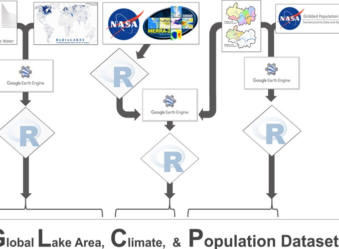
An increasing population in conjunction with a changing climate necessitates a detailed understanding of water abundance at multiple spatial and temporal scales. Remote sensing has provided massive data volumes to track fluctuations in water quantity, yet contextualizing water abundance with other local, regional, and global trends remains challenging by often requiring large computational resources to combine multiple data sources into analytically-friendly formats. To bridge this gap and facilitate future freshwater research opportunities, we harmonized existing global datasets to create the Global Lake area, Climate, and Population (GLCP) dataset. The GLCP is a compilation of lake surface area for 1.42 + million lakes and reservoirs of at least 10 ha in size from 1995 to 2015 with co-located basin-level temperature, precipitation, and population data. The GLCP was created with FAIR (findable, accessible, interoperable, reusable) data principles in mind and retains unique identifiers from parent datasets to expedite interoperability. The GLCP offers critical data for basic and applied investigations of lake surface area and water quantity at local, regional, and global scales.