 Image credit: Meyer et al 2020
Image credit: Meyer et al 2020
Image credit: Meyer et al 2020
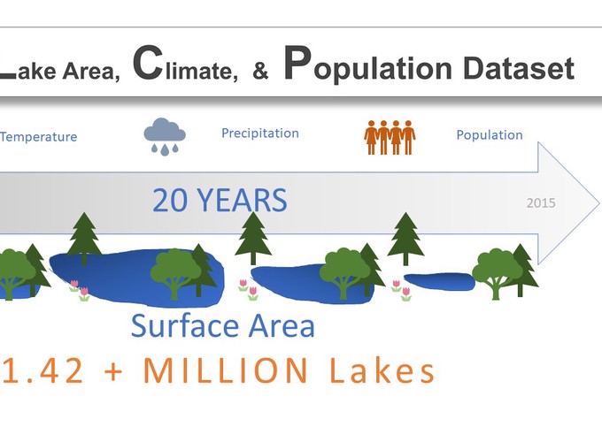
Given climatic uncertainty and human population growth, tracking the world’s freshwater availability is essential. Fortunately, data necessary to identify surface water patterns are abundant. Wrangling these data into an analytically friendly format, however, can be difficult for researchers not experienced in data manipulation and high‐performance computing. To increase data accessibility, we developed the Global Lake area, Climate, and Population (GLCP) dataset. The GLCP offers annually aggregated surface area, temperature, precipitation, and human population estimates for over 1.42 million lakes globally between 1995 and 2015. Our dataset is peer‐reviewed and publicly available in a tabular format, enabling researchers with a range of skill levels to effectively work with the data. All aggregation procedures were performed within Google Earth Engine and R, empowering future users to replicate and modify scripts. Three case studies are presented to highlight concrete applications of the GLCP with emphasis on natural resource management at local, regional, and national scales.